Whatsapp:+44 7726271886
support@sensingxtech.com
Currency


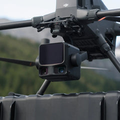


DJI Bundle Worry-Free Plus Zenmuse L3 flagship long-range LiDAR and imaging payload engineered for precision aerial mapping, topographic modeling, and high-detail inspection.
...
- $16,900.00
$16,900.00- $16,900.00
- Unit price
- per
Please hurry! Only 2 left in stock
Limited-Time Offers, End in:
151D
8H
23M
0S
Subtotal:
$16,900.00
Couldn't load pickup availability
Free Shipping
Free standard shipping


Description
x
DJI's next-generation high-accuracy aerial LiDAR system features a long-range LiDAR capable of reaching up to 950 m even on objects with just 10% reflectivity.
Dual 100MP RGB mapping cameras and a high-precision POS system accelerate geospatial data acquisition, enabling daily coverage of up to 100 km².
Specifications


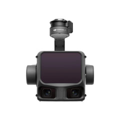
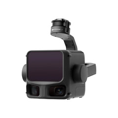
Dual 100MP RGB Mapping Camera System
Equipped with dual 100MP 4/3 CMOS RGB sensors and a mechanical shutter, Zenmuse L3 delivers significantly enhanced accuracy and efficiency.
Pixel binning supports an effective 25MP resolution.

High Accuracy
Vertical accuracy is better than 3cm at 120m altitude, better than 5cm at 300m,
and better than 10 cm at 500m, easily supporting mapping projects at 1:500, 1:1000, and 1:2000 scales.
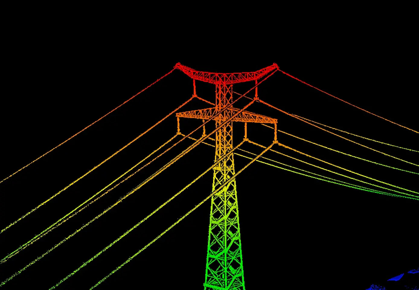
High Penetration
Provides superior penetration capability with a smaller laser spot and higher single-pulse energy.
For terrain mapping and similar uses, L3 captures more complete ground points for better results.

High Efficiency
When mounted on DJI Matrice 400, Zenmuse L3 delivers outstanding efficiency.
At a flight altitude of 300 m, a single flight can cover up to 10 km², enabling up to 100 km² of daily coverage.

End-To-End Solution
Zenmuse L3 integrates with DJI's ecosystem to deliver an end-to-end mapping solution.
Enjoy simpler, unified workflows from data acquisition and processing to application.

In the Box

Related Products
Recently Viewed Products
- Choosing a selection results in a full page refresh.